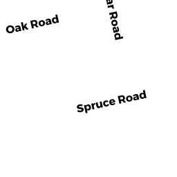
16 SPRUCE RD
Owner Information
GALPIN RACHEL A
16 SPRUCE RD
WESTFORD, MA 01886


Property Details
16 SPRUCE RD is classified as a Two-Family Residential (Gambrel).
The primary structure on this property was built in 1984. There are 2,824ft2 of built area within this property. There is 2,824ft2 of residential/living space within this property. This property is listed as having 10 rooms. There are 2 units within this property.
16 SPRUCE RD is valued at $571,600. The land is valued at $220,900 and the structures are valued at $350,700.
This property is in Zone RB. Confirm with local Zoning Board authorities to ensure there are no overlays or other easements on this property.
The most recent deed for 16 SPRUCE RD is recorded at the local registrar in Book 26108, Page 93. 16 SPRUCE RD was last sold on Thursday, June 21, 2012 for $460,000.
Assessment data from fiscal year 2021.
Flood Data
According to the FEMA National Flood Hazard Layer, this property does not appear to be in a flood zone. It may also be in an area not yet reviewed. Nonetheless, confirm this information prior to taking any action.
To view the flood hazards around this property, create a FEMA "Firmette" Map of the area around 16 SPRUCE RD.
Broadband Internet Providers
| Provider | Type | Bandwidth (mbps) | |
|---|---|---|---|
| VSAT Systems, LLC. | Satellite | 2 | 1 |
| HughesNet | Satellite | 25 | 3 |
| GCI Communication Corp. | Satellite | 0 | 0 |
| Comcast | Cable | 1000 | 35 |
| Verizon New England Inc. | Fiber | 940 | 880 |
| Viasat Inc | Satellite | 100 | 3 |
Broadband service provider data from December 2020.
Adjacent Properties
- 7 POPLAR RD
Single Family Residential owned by DULCZEWSKI DAVID J. - 9 POPLAR RD
Single Family Residential owned by CAFARELLI JOHN - 23 OAK RD
Single Family Residential owned by GORDON KEITH B - 18 SPRUCE RD
Single Family Residential owned by NICK R & JEAN W SCHOTT (le) - 25 OAK RD
Single Family Residential owned by FLANIGAN RYAN PATRICK